

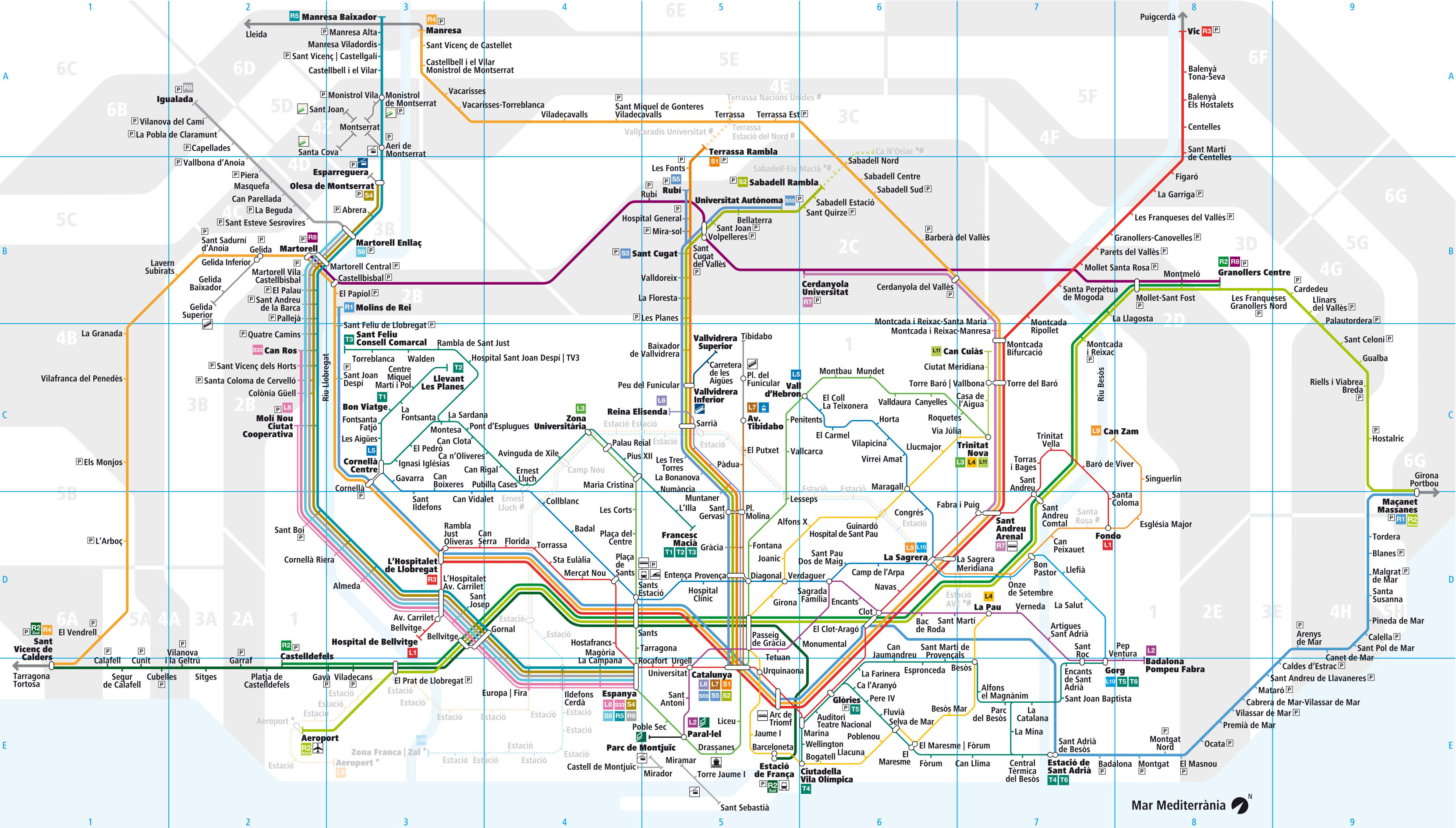
You can find on this page the map of Barcelona suburban train. The Barcelona urban, suburban & communter train also called Rodalies or Cercanías is a transit system serving the city of Barcelona (Spain) with the subway, the tram, the bus or the Nitbus night bus. The commuter train network has 15 lines and 228 stations forming a rail network of 382 miles (615 km).
Barcelona trains exist since 1980 and are operated by the RENFE (Red Nacional de los Ferrocarriles Españoles) and the FGC (Ferrocarrils de la Generalitat de Catalunya).
Its network includes the following 15 lines:
• Line R1 (Renfe): Molins de Rei ↔ Maçanet Massanes
• Line R2 (Renfe): Aeroport / Castelldefels ↔ Granollers Centre / Maçanet Massanes
• Line R3 (Renfe): L'Hospitalet del Llobregat ↔ La tor de Querol
• Line R4 (Renfe): Sant Vicenç de Calders ↔ Manresa
• Line R5 (FGC): Barcelona - Plaça Espanya ↔ Manresa
• Line R6 (FGC): Barcelona - Plaça Espanya ↔ Igualada
• Line R7 (Renfe): Sant Andreu Arenal ↔ Cerdanyola Universitat
• Line R8 (Renfe): Martorell ↔ Granollers Centre
• Line S1 (FGC): Barcelona - Plaça Catalunya ↔ Terrassa - Rambla
• Line S2 (FGC): Barcelona - Plaça Catalunya ↔ Sabadell - Rambla
• Line S5 (FGC): Barcelona - Plaça Catalunya ↔ Sant Cugat - Rubí
• Line S55 (FGC): Barcelona - Plaça Catalunya ↔ Universitat Autónoma
• Line S33 (FGC): Barcelona - Plaça Espanya ↔ Can Ros
• Line S4 (FGC): Barcelona - Plaça Espanya ↔ Olesa de Montserrat
• Line S8 (FGC): Barcelona - Plaça Espanya ↔ Martorell Enllaç


